
.

.


Main photo gallerys are below Information.
Launceston's CATARACT GORGE
SMALL PHOTO & INFORMATION PAGE
Launceston's CATARACT GORGE is a spectacular gorge on the north western edge of Launceston City. It begins just west of the old Kings Bridge. Here you can see towering cliffs, giant trees and peaceful waters. There are also many peacocks and wallabies wandering around the tourist areas. The area is flood lighted at night. There are many walks, both easy and hard, in the Gorge area. There is also a great lookout and a long walk to the Duck Reach power station and the Trevallyn Dam for good walkers. At First Basin, in the heart of the Gorge, are 2 cafes, plus a large car park. There is wheel chair access to Cataract Gorge that begins on the south side of the First Basin area. The other sights of Launceston are also discussed in the LAUNCESTON CITY, TREVALLYN, TAMAR ISLAND and TASMANIA ZOO pages.
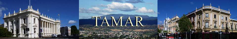
From LAUNCESTON you are 20 minutes from EVANDALE, LONGFORD, CARRICK, EXETER, TAMAR ISLAND and TASMANIA ZOO, GRINDELWALD.
You are 40 minutes from BEACONSFIELD, BEAUTY POINT, LILYDALE, GEORGE TOWN, WESTBURY, Mt BARROW, Mt ARTHUR, LONGFORD and DELORAINE.
You are 60 minutes from GREENS BEACH, the NARAWNTAPU, Mt BEN LOMOND, Mt BEN NEVIS, SCOTTSDALE, WEYMOUTH, CAMPBELL TOWN, MOLE CREEK, the GREAT LAKE, LIFFEY FALLS and DEVONPORT. Nearby places are described in the TAMAR VALLEY REGION page.
View Region Tamar in a larger map
View Launceston in a larger map
FACILITIES: There is a cafe and restaurant at the First Basin of Cataract Gorge. Launceston is the second city of Tasmania. There is a huge shopping precinct in the Launceston CBD. There are more shopping precincts in the suburbs. There is much accommodation in LAUNCESTON.
TOURIST information is at Cornwall Square, 16 St John Street, Launceston City, The telephone number is (03) 6336 3133 or contact www.visitlauncestontamar.com.au
SIGHTS: Launceston's Cataract Gorge is a highlight of the City. It begins in the CBD at King's Bridge and continues for many kilometres to Trevallyn Dam. Most people do the short walk from King's Bridge to FIRST BASIN, where there is a lovely old kiosk and restaurant.
-
CHAIR LIFT gives you a beautiful birds eye view of First Basin. The telephone number is (03) 6331 5915 or the Internet contact is www.launcestoncataractgorge.com.au
-
CATARACT GORGE CRUISES sail the beautiful Tamar River. The telephone is (03) 6334 9900 or 0439 302 318
There is an easy walk north of the river to the First Basin of the Cataract Gorge and a more difficult walk south of the river. Both begin at Kings Bridge.
The more intrepid walk the extra kilometres to the old DUCK REACH Power Station of Cataract Gorge. Other walking tracks go all the way to the TREVALLYN DAM.
Near the old gate keepers house at Kings Bridge is a stair way that takes you to a lookout and walk deep into TREVALLYN, where you can see its fine old houses.
ROUTES: From the LAUNCESTON CBD just walk to the river at King's Bridge.
Alternatively from the LAUNCESTON CBD you can drive west on Paterson Street, which will take you across the old King's Bridge. This continues up the hill as Trevallyn Road. Turn north on Gorge Road and follow it into the park.
Finally you can reach the Gorge by turning west on Frederick Street and following it up the hill into historic West Launceston. Then turn north onto Basin Road and follow it to the Cataract Gorge Car Park. This route is well signed.
To LARGER CATARACT PHOTOS
- LOWER GORGE
- First Basin
- Duckreach
- Trevallyn Dam
- 2016 Flood
- 2021 Flood
- 2022 Flood

1/ The Cataract Gorge is located in Launceston in north eastern Tasmania. This photo shows the King's Bridge. The easiest walk around the Cataract Gorge begins or ends at King's Bridge on the northern side of the Gorge. The track on the southern side is much more difficult.
![]()
2/ The ancient caretaker's house marks the start of the walk to the First Basin area of Cataract Gorge.

3/ Cruise boats tour the lower part of Cataract Gorge near Kings Bridge

4/ Cataract Gorge can be an awesome sight. This photo was taken during the flood of 2012. As you can see, this walk can be accessed even by wheel chairs.

5/ This is the view into the cauldron of Cataract Gorge from a higher lookout during the 2012 flood.

6/ This is a view looking into the Cataract Gorge during the flood of 2012.

7/ The easy walkway snakes around the edge of the Cataract Gorge on a raised platform.

1/ This is the chair lift view of the cafe and pool at the First Basin park area of Cataract Gorge.

2/ This shows the same view during the 2012 flood. As you can see, it truly was an awesome sight.

3/ This photo shows the chair lift crossing the causeway at the First Basin of Cataract Gorge.

4/ This is a summers day view of the lawn at First Basin looking towards the Alexander Suspension Bridge. This area of Cataract Gorge is a favorite bathing area with the young people of Launceston.

5/ An elevator now takes patrons from the upper car park to the First Basin lawn area. Access to Cataract Gorge has been improved for disabled people.

6/ This photo shows the causeway of First Basin with the chair lift above. Cataract Gorge is the most popular area of Launceston.

7/ On the western side of First Basin is a forested area with a lovely old rotunda. The toilets are under it.

8/ Near the rotunda are some enormous pines, which are over a century in age. The Cataract Gorge was once the garden property of a Launceston millionaire.

9/ On the morning of 5 August 2020 it snowed in Launceston for the first time since 1971. I went down to First Basin to see the effect. To the right is the old rotunda and on the left is the kiosk.

10/ The snow added a unique new element to the old kiosk.

11/ This is the children's play area. On the right you can see a snowman that someone had built.

12/ The paths and lawns were covered in snow.

13/ The snow gave the rocks a strange new colour. By 11 am much of the snow had melted.

14/ This was the view across the Gorge to the restaurant and swimming pool.

1/ The walk to the Duck Reach Power Station of Cataract Gorge begins at the Alexander Bridge at First Basin. This is an ancient cable bridge built about 1900.

2/ The walkway across the Alexander cable bridge is narrow and it sways in the wind. It is closed for safety in heavy winds.

3/ This was the view from the Alexander lookout during the great flood of 2016. The Cataract Gorge that day was an awesome sight.

4/ This image shows the view from the Alexander Bridge looking towards the south. The rough track to the Duckreach Power Station is to the left.

5/ This view from the Alexander Bridge shows the First Basin Lawn during the small 2021 flood.

6/ This image shows the Alexander Bridge during a small flood in 2021.

7/ This is the start of the walk to Duckreach. It is harder to walk than the easy walk from the Launceston CBD to the First Basin.

8/ This image shows a view of the South Esk River as you walk towards Duckreach.

9/ This view is one of the many small cascades.

10/ This is your first view of the Duckreach Power Station and bridge.

11/ I was lucky to be able to capture this beautiful view of the South Esk River near Duckreach.

12/ The walk ends when you reach the old Duck Reach Power Station. This once provided power to the city of Launceston. The device on the right was once part of a cable car that took workers across the Gorge from the hamlet on the southern side.

13/ This is the view inside the power station. Here you can see some of the pipes and one of the generators that once made electrical power for nearby Launceston.

14/ This is the one surviving generator. Behind it is a photo and next to it is an explanation panel. There are many other explanation panels inside the power station.

15/ This is the view from the north face of the Cataract Gorge. Below is the power station and the bridge. Note how the pipes flow down hill to power the turbines in the power station below. The climb up the north face involves ascending a steep stairway. This track goes to the Trevallyn Dam.

16/ This telephoto image shows the remains of the hamlet on the southern side of Duckreach, where the workers once lived and came across the Gorge in a cable car.

17/ This is the ancient Duckreach Bridge. During the Great Flood of 1929 the original bridge was destroyed.

18/ This is the view as you approach the Duckreach Bridge tower on the southern side. There is a steep stairway ascending the south face as well, so it is not for the unfit.

19/ This is view to the north east of the Duckreach Bridge.

20/ This is the view to the south west of Duckreach.

21/ This is another view towards the south west of Duckreach.

1/ The walks from First Basin eventually lead to the impressive sight of the Trevallyn Dam. Watching the water flow over the spill way is an impressive site.

2/ This image shows the action at the base of the dam.

3/ This image shows the waters flowing down to the South Esk River.

4/ A new feature of the dam is the eel ladder, which is incorporated into the structure.

5/ This monument at the Trevallyn Dam Park honours the polish workers who built the dam between the years 1947 to 1965.

6/ The track continues from the Trevallyn Dam to Aquatic Point. This track contains a large section of cut stone stairs. These stones have an ancient European feel about them. Perhaps they were built by the Polish dam workers?

7/ Aquatic Point is picnic ground with a toilet and a boat launch. Beyond the trees to the right is a pebble beach used by swimmers.

8/ This image shows the pebble beach at Aquatic Point. Tasmanians swim here even in winter.

1/ On Tuesday 7 June 2016 northern Tasmania was hit by very heavy downpours of rain. The result was the flooding of a number of rivers including the South Esk River that flows into Launceston. This caused a flood that was even worse than the infamous 1929 flood. The photo above shows the bridge to the Duckreach power station. Pulses of water were actually reaching the floor of the bridge. The tower opposite was destroyed in the 1929 flood, but it survived this flood. This photo was taken on Thursday. By this time the river had already subsided somewhat from its peak. To fully appreciate the flood, you should compare these photos to the photos of similar views shown in my other Cataract Gorge galleries.

2/ This photo shows the South Esk River surging past the Duckreach power station. It was taken on Thursday and does not show the flood at its peak. Compare this image of a raging torrent to the placid river shown in the other galleries.

3/ This photo was taken late on Tuesday and shows the flood at its peak. It looks across from the south side of the river to the old Duckreach power station. You can plainly see that some of the pulses of the flood surge are the same height as the bridge.

4/ This photo was taken on the Thursday from Duckreach power station on the northern side of the river. You can plainly see that pulses of the surge are still higher than the bridge. Access to the power station was closed on Tuesday and Wednesday on my side of the river, so I can only imagine what an awesome sight it must have been at its height on Tuesday.

5/ This was the view on Thursday of the South Esk River surging past the Duckreach power station. We saw lots of evidence on floor of the power station that it had recently been under water.

6/ This photo was taken late on Tuesday from the south side of the river. It plainly shows the water surging through the old power station. The position that I took the photo above from is under one metre of water in this photo. A similar flood in 1929 destroyed this power station.

7/ This photo was taken late on Tuesday and shows the flood waters surging past the bridge at Duckreach. You can see that the bridge was locked for safety reasons.

8/ One kilometre up river from the Duckreach power station is the Trevallyn Dam. This photo was taken on Thursday and it shows the waters surging over the spill way. I estimated that the spray was at least 12 metres in height. The spray was so intense, even at my height, that it fogged up my camera's lens. The roar of the water was almost deafening. It was truly an awesome sight.

9/ This photo was taken from the Trevallyn Dam tower. I noted that the water flowing over the spill way created this interesting artistic effect.

10/ This photo shows a full image of the Trevallyn Dam on the Thursday, so that you can appreciate the extent of the flow. If you look at my photo in the Trevallyn Dam gallery, you can see that the water level was now more than a metre higher over the spill way wall.

11/ This photo was taken on Wednesday at First Basin. This is about 2 kilometres south of the Trevallyn Dam shown above. It looks south across the First Basin towards the cafe. You can plainly see that the water has flooded the lower level of the cafe. It did not reach this level in the 2012 flood.
12/ This photo was taken from the Eyrie Lookout on the north side of First Basin. It shows the area in normal times. You can plainly see that the cafe is about 100 metres from the river shore line. Compare this to the image above.

13/ This photo looks south west towards the Alexander Bridge that joins the two halves of First Basin. It was taken on Wednesday and plainly shows pulses of water that are still higher than the bridge. When I took this photo on the Wednesday, the rangers were worried that the bridge would be destroyed, as it was being regularly pounded by logs being propelled down stream by the flood.

14/ This photo was taken late on Tuesday from the south side of the First Basin at the height of the flood. You can plainly see that the water has reached the second storey of the cafe. This water level is higher than what you can see in my photo of the cafe above that was taken the following day.

15/ This photo was taken on Tuesday. It represented a tragic sight for the cafe owners. You can plainly see that the flood waters were now flooding into the second storey of the cafe. The South Esk River has never been this high before.

16/ This photo was also taken on Tuesday, but later in the day. The flood had receded slightly to reveal the children's play equipment. The photo also shows how the whole of the First Basin area was inundated by a raging torrent.

17/ The track to the lower gorge was blocked on Wednesday, so this was the best view that I could get looking towards Kings Bridge. You can see the flood waters raging down towards the Launceston CBD. The red tower in the distance is the old post office.

18/ This photo looks across First Basin to the Zig Zag Track. It shows the flood waters rushing down towards the Kings Bridge. These rocks are normally far above the water line.

19/ This is a photo of the Kings Bridge. This bridge is about one kilometre from the First Basin. This bridge connects the north western side of Launceston to the rest of the city. It was taken late on Tuesday. The water rushing past had already reached a dangerously high new level. The more modern bridge located just east of this bridge was already closed to traffic and all traffic was being diverted to this much older bridge. At the time I was worried that Launceston would be cut in two.

20/ Launceston is protected by a high flood levee. For the first time in years the flood gates had to be closed. This was a very worrying development for the people of the lower city. It has reignited the debate, as to how high this levee should be.

1/ This was the view from the Alexander Lookout towards the First Basin Cafe. The swimming pool was inundated, but the flood did not reach the cafe, like in 2016.

2/ This image looks down at the Alexander Bridge. Note the swirling water below. The First Basin cafe is on the extreme top right.

3/ This image looks down towards the First Basin Causeway. It is now totally inundated.

4/ We now walked towards the Kings Bridge and the Launceston CBD. This image looks back towards the inundated Causeway and the Alexander Bridge.

5/ This image shows the raging torrents of water rushing over the rocks. The sound was deafening.

6/ This image shows the view from the Kings Bridge looking back down the Gorge. Note how the raging torrents ubruptly become calm, once they have passed over the rocks.

7/ We then returned to First Basin and walked the trail to Duckreach. This was our view of the raging waters of the upper Gorge. I noted how the waters had turned the centre of the Gorge into an island.

8/ This image shows the waters rushing around the edge of the new island.

9/ This image shows our first view of the old Duckreach Power Station. The fog gives the view an ethereal feeling. Note the waters swirling over the rocks near the power station.

10/ This image shows the waters swirling under the Duckreach Suspension Bridge.

11/ This image shows the view from the Duckreach Suspension Bridge looking back towards First Basin. It was a very impressive sight.

12/ This image from the bridge shows the other view looking towards the Trevallyn Dam.

1/ In 2022 Launceston experience very heavy rains leading to the flooding of the South Esk River. This flood was spectacular, but it was not as heavy as the 2016 flood. This photo shows the view from the Alexander Lookout looking down at the Alexander Bridge. To the top right of this photo is the cafe and swimming pool of First Basin.

2/ This photo shows First Basin the day before. Notice that the water has reached the swimming pool, but it has not yet reached the cafe.

3/ The next day the flood peaked and almost reached the cafe. The 2016 flood reached the first storey of the cafe.

4/ This photo looks across to First Basin. The lower track has now been flooded. The water was surging and I got my feet wet in a sudden surge of water.

5/ This photo shows the view as I walked towards Kings Bridge.

6/ This view looks back towards First Basin and the Alexander Bridge. Under the surging water in the middle is the causeway.

8/ This view shows tumults of water. They really were as high as the lookout.

9/ This wider view shows the full violence of the surging waters.

10/ This photo shows a closer view of a tumult. The roar of the water was almost deafening.

11/ This is another view of the roaring waters.

12/ At this lookout the waters started to calm.

13/ This view shows how the waters were calming after crossing the last of the rapids.

14/ This photo shows the flow under the Kings Bridge.

15/ I then returned to First Basin and crossed the Alexander Bridge. This photo shows the view up the raging South Esk River.

16/ This was the river at Duck Reach. The view in 2016 was much more impressive.

17/ A tremendous rush of water was coming over the spillway of the Trevallyn Dam.

18/ The rush of waters were creating a cloud of spray.

19/ This was the view at Duck Reach a few days later. It was calm and beautiful.

20/ This the view on the walk back to First Basin.

21/ This was the causeway at First Basin. It was hidden under the raging waters that you can see in photo number 6, while now it was placid and ethereal.

