
.

.


Main photo gallerys are below Information.
NARAWNTAPU National Park
SMALL PHOTO & INFORMATION PAGE
NARAWNTAPU National Park is a beautiful coastal park with great beaches, a bird viewing area and a lawn, where you can see Tasmanian animals. There is a cafe and a shop at the visitor centre. The easy walks, plus easy bird and animal viewing make it a great place to visit. The park can be accessed from both the eastern, Greens Beach, end and the western, Port Sorell, end. A day trip is needed to see each end of the park. It is located north of Launceston and east of Devonport.
The two entrance beaches are on opposite sides of the park.
-
BADGER BEACH on the eastern side of Narawntapu is just 10 minutes drive from GREENS BEACH and 15 minutes from BEACONSFIELD and BEAUTY POINT. It is 30 minutes from EXETER, GRINDELWALD, TASMANIA ZOO and GEORGE TOWN and 50 minutes from LAUNCESTON.
-
BAKERS BEACH on the western side is 20 minutes from PORT SORELL and 30 minutes from LATROBE and DEVONPORT.
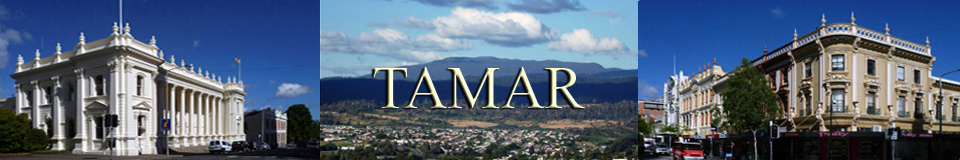
View Region Tamar in a larger map
FACILITIES: There is a shop at the Visitor Centre at the park entrance. For information the telephone is (03) 6383 9102 The nearest shopping precincts are Port Sorell and DEVONPORT on the western side and BEACONSFIELD on the eastern side. There is some accommodation in the WEST TAMAR.
SIGHTS: Narawntapu is the new name for the former Asbestos Range National Park. It is a coastal park with two beaches: Bakers and Badger, plus many easy walks.
-
BAKERS BEACH on the western side has a first class bird viewing facility at the lagoon. From the lawn you can see a variety of native animals. There is also a great view of the park from the ARCHERS KNOB hill.
-
BADGER BEACH on the eastern side has a beautiful long beach, plus a great cliff walk at West Head Point.
ROUTES: From LAUNCESTON drive north on the A7 West Tamar Highway for about 60 kilometres, until you see the sign pointing to the eastern entrance to the Badgers Beach entrance of Narawntapu National Park.
From DEVONPORT and Port Sorell drive East on B71, until you see the north pointing sign to the western entrance to Bakers Beach entrance of Narawntapu National Park. This access road is just east of the Port Sorell Bay. The last part of this access road is gravel, but it is usually in a good condition.
To LARGER NARAWNTAPU PHOTOS
- BADGER BEACH
- BAKERS BEACH

1/ The Narawntapu National Park is in the north east of Tasmania. This is the eastern corner of Badgers Beach of the looking to the west towards West Head Point across the sands.

2/ This photo shows some of the towering granite cliffs of Narawntapu looking towards Badgers Beach from the West Head Point.

3/ A rugged, granite wall of West Head Point peers down over Badgers Beach, Narawntapu.

4/ This is West Head Lookout of Narawntapu looking to the east across the mouth of the Tamar River.

5/ This photo shows a long view of Badgers Beach looking towards West Head. The Badgers Beach settlement is off this beach.

6/ This is the view looking back towards Badger Beach. It shows a large part of the Narawntapu National Park.

7/ This photo shows the rugged cliffs along the track to Copper Cove. It is one of the many cliffs of Narawntapu.

8/ This photo shows a long range view of Copper Cove on the western edge of Narawntapu. Note that the beach is not as good as Badgers or Bakers beaches.

9/ From the track you see the large variety of vegetation that Narawntapu contains.

10/ This photo shows a gully near Copper Cove. This gully was once used by copper miners. Asbestos was also mined in another part of Narawntapu.

11/ The rocky beach at Copper Cove was not a safe place for swimming, unlike the other beaches of Narawntapu.

12/ This photo shows the rocky beach at Copper Cove looking towards Badger Head Point, at the eastern edge of Narawntapu National Park.

13/ The beach at Copper Cove contained a strange green algae, which may have been caused by ancient mining in Narawntapu.

14/ This photo shows a view of the rocks looking west towards Little Badger Head Point.

15/ This photo shows a fresh water creek at Copper Cove. It is unlikely to be safe to drink. You are well advised to bring and drink your own water at Narawntapu.

16/ This section of Copper Cove contained a lot of drift wood. Some of the wood showed human crafting. This may be a remnant of ancient mining at Narawntapu.

1/ Bakers Beach is on the western side of Narawntapu. It is a huge white sand beach that begins after Little Badger Head Point. It is just t0 the West of Copper Cove. The beach continues to Griffiths Point.

2/ The sand and swimming are first class at Bakers Beach on the western edge of Narawntapu.

3/ This photo shows Little Badger Head Point at the eastern end of Bakers Beach. This head divides the two major beaches of Narawntapu.

4/ A walkway from the ranger station at Bakers Beach takes you towards the large lagoon from where you can see many water birds. Narawntapu is also a significant wetlands bird sanctuary.

5/ From the bird hide you have a great view of the many types of birds on the lake of Narawntapu.

6/ The still waters of the lake contained some unusual vegetation floating around these paper bark trees.

7/ This photo looks out through paper bark trees on the large lake to the South of Narawntapu.

8/ There is a huge variety of swamp vegetation on the edge of the lake. This supports a huge variety of life.

9/ From the bird hide you can look across the vast lake at the many water birds using the lake of Narawntapu.

10/ The Narawntapu track joins the two beach of Badgers and Bakers. This photo shows the track near the Archer's Knob. This is the highest point of Narawntapu.

11/ This photo shows the track up Archer's Knob. The view is towards Bakers Beach and Little Badger Head Point at the eastern side of Narawntapu.

12/ This photo is looking South from Archer's Knob to the hills on the southern part Narawntapu.

13/ This photo is looking West from Archer's Knob towards the lake. The mountain towards the left is Mt Roland.

14/ This photo from Archer's Knob shows the lawn and lake on the left and Baker's Beach on the right. The lawn is a great place to see wombats and kangaroos and is thus a major attraction of Narawntapu.

15/ This is a photo taken from Archer's Knob looking South West over the wild life lawn towards the distant hills beyond Narawntapu.

