
.

.


Main photo gallerys are below Information.
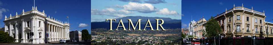
MOUNT ARTHUR
Mt Direction, Patersonia, Nunamara & Hollybank
SMALL PHOTO & INFORMATION PAGE
Mount ARTHUR is a majestic peak located east of Launceston and just south of the town of Lilydale in the north east of Tasmania. There is an interesting bush walk to the summit plateau of Mt Arthur for the fit. This begins just south of Lilydale. There are also some interesting rural drives around Mt Arthur and a lovely family park at HOLLYBANK. There are no facilities on Mt Arthur and the nearest accommodation is at Launceston.
Mount DIRECTION is a small mountain just east of the Tamar River and north of Launceston. There is a short walk to the summit, where you can see the remains of the old signal station.
PATERSONIA and NUMAMARA are pretty, rural localities located north east of Launceston, which have great views of Mt Arthur.
HOLLYBANK Park is a lovely picnic ground and easy bush walking area with an exciting aerial ride. It is just 10 kilometres north east of Launceston.
In terms of access you can interpret the Mt Arthur area as being part of both the TAMAR VALLEY and the NORTH EAST.
From the Mt Arthur turnoff you are 5 minutes from LILYDALE, 20 minutes from LAUNCESTON and MT BARROW and 30 minutes from SCOTTSDALE and GEORGE TOWN. You are 60 minutes from BRIDPORT and DERBY. Nearby places are described in the NORTH EAST REGION page.
View Region Tamar in a larger map
FACILITIES: There are no commercial facilities on Mount Arthur, but there is a picnic ground at the base of the mountain. The nearest shops are at LILYDALE. There are no facilities at Patersonia, Nunamara or Mt Direction. The nearest shopping precinct is in Launceston. There is much accommodation in LAUNCESTON.
SIGHTS: The peak of Mt Arthur dominates the eastern skyline of LAUNCESTON. Mt Arthur is north west of Mt. BARROW. From the peak of Mt ARTHUR there are spectacular views of Launceston and the Tamar Valley. However, you will have to be prepared to walk and climb to reach its summit.
There is a historic signal station on the top of Mt DIRECTION and there is a lovely park at HOLLYBANK. You can see great views of Mt Arthur from PATERSONIA, while there are some historic buildings at NUNAMARA.
ROUTE: From the Launceston suburb of Rocherlea drive north East on B81 Lilydale Road for 16 kilometres. Just south of Lilydale turn east onto C827 Mountain Road. Drive east for about 4 kilometres to the car park. The walk to the summit is a steep 3 kilometre track.
To reach Nunamara from Launceston drive north east on the A3 Tasman Highway for about 12 kilometres. At Nunamara there is a turnoff to Patersonia.
To reach Hollybank from Launceston, you drive north from the suburb of Rocherlea towards Lilydale. About 10 kilometres north of Rocherlea you will see the turnoff to Hollybank.
To reach Mt Direction from Launceston drive north on the A8 East Tasman Highway for about 15 kilometres, until you see a turnoff to Mt Direction.
To LARGER Mt ARTHUR PHOTOS
- Mt ARTHUR
- Patersonia
- Nunamara
- Mt Direction
- Hollybank

1/ Mt Arthur is in north eastern Tasmania. This is the view from only 10 kilometres away.

2/ The approach to Mt Arthur is through lush dairy country East of Lilydale.

3/ The Mt Arthur summit requires a moderate 5 hour return walk.

4/ Part of the track to Mt Arthur is via the old maintenance road. Other parts of the track were harder to follow.

5/ This is a view from half way up the summit of Mt Arthur. Fog prevented my full ascent that day.

6/ This photo shows Mt Arthur from the eastern side near Lisle.

7/ This is the view from near the top plateau of Mt Arthur. It looks north to the Tamar Valley.

8/ This shows the view towards the north east. It is a hard climb to reach the summit.

9/ The top of Mr Arthur is a rocky plateau. This view was taken near the summit cairn. There are three commications towers on this mountain. Their maintenance is done by helicopoter.

10/ This is the cairn at the summit. It marks the highest point of Mt Arthur. It was built up by climbers over the years each placing a stone on it.

1/ Patersonia is a locality north east of Launceston and south of Mount Arthur. It is located off the main A3 Tasman Highway, the road to Scottsdale and the east coast. It was once a much larger community that provided food for the nearby Lisle gold field. This is the church at Patersonia.

2/ This is the ancient road that connected Patersonia to the Lisle gold field. The peak in the distance is Mt Arthur.

3/ This photo shows the lush meadows of a farm close to Mt Arthur. The old shed shows that it is very old.

4/ This lush meadow was a sheep's paradise. They had so much grass that they were not even bothering to stand up.

5/ This is another view of Mount Arthur taken from the south west of the peak.

6/ This photo was taken from the northern slopes of Mount Arthur on the old road to Lisle.

1/ Nunamara is a locality on the A3 Highway that connects Launceston to Scottsdale in the north east of Tasmania. It is is south west of Patersonia. Nunamara was once a much larger settlement. This photo shows the historic hotel, where travellers once stopped on their way to the nearby Lisle gold field.

2/ This 19th Century style house was once a coach house.

3/ This is the 19th Century town hall of Nunamara. Its existence proves that the settlement was once much larger than it is today.

4/ Just east of Nunamara is Mt Barrow. This photo shows the lovely view of Mt Barrow that you see.

5/ Just north east of Nunamara on the Tasman Highway is a special road called the Mount Barrow Discovery Trail. This is an old forestry track that has been upgraded into a tourist route. The road is gravel, but the gravel was in a high state of repair, when I visited it in 2017, which made in suitable for SUV or 4WD cars. The trail passes mostly through degraded forest, but it does include a great lookout and a lovely, remnant myrtle grove.

6/ This image shows the road and shows the lovely myrtle grove that we visited.

7/ The myrtle grove is an enchanting place. Ancient, giant myrtles shade the ground allowing a carpet of mosses to flourish. Here you can see the ancient myrtles and beyond them the access road.

8/ The myrtle grove is dominated by a stream. Some group has marked out a potential trail on the right side of this image, but no track has yet been laid out.

9/ This image shows the plethora of shapes and colours that you see in the lovely myrtle grove.

10/ The grove was very enchanting, but the lack of a defined route means that you have to wend and weaver your way around the many trees and bushes.

11/ When sun light breaks through the canopy, the mosses light up into a brilliant shade of green.

12/ Here you can see the many varieties of mosses that dominate the grove.

13/ This is the view skyward. You can see how the myrtle canopy soaks up the sunlight in most areas.

14/ The grand, old myrtles begin as little saplings like this one. If they are lucky enough to germinate in a patch of light then 200 years from now, they will grow up into magnificent giants.

1/ Mt Direction is a small mountain north east of Launceston and west of Mt Arthur. It is 370 metres high, so it was chosen to be the perch for a semaphore station in 1840. This was part of a chain of semaphore stations that linked Launceston to George Town. The semaphores were used to pass advance warning of the arrival ships for the benefit of the merchants of Launceston. This photo shows the semaphore tower with its arms. To the left is an ancient cairn that was used by the early surveyors of Tasmania. You can see another semaphore tower on my George Town page in the Mt George tab. The semaphore tower on Mt George once used to talk to this semaphore tower on Mt Direction.

2/ This is ruins of the house where the semaphore master lived with his family. It dates from about 1843. There were 2 wooden huts for the convicts nearby.

3/ This is the route from the house to the well. An ancient stone wall marks the route. As you can see, the whole area is now quite overgrown and the views it once commanded of Launceston and Mt George are now obscured by trees.

4/ This is the well where the residents once drew their water. The presence of this well made life a lot easier for the residents of the semaphore station.

5/ This is the view from the Mt Direction semaphore station of nearby Launceston. Unfortunately, trees now obscure the views of Launceston and of Mt George near George Town that were once seen by the semaphore operators. The whole site needs a major restoration effort to bring back the views that it once commanded.

6/ This is the information hut at the base of Mt Direction. There is a picnic table, but there is no toilet. It is a moderately difficult 2 kilometre walk up hill to the ancient semaphore station.

1/ Hollybank is a magical park about 10 kilometres north east of Launceston. It is a favorite picnic ground for people from Launceston, as it has a beautiful mixture of European and native trees. It is also the site of the Hollybank Treetop Adventure, which allows you to fly down the nearby Piper River. This photo shows the edge of the cricket ground, which is near the centre of Hollybank and holds the picnic facilities.

2/ This is the Avenue at Hollybank. It is an ancient tram route, which is lines with oak trees. I was fortunate to have photographed them in our autumn, while they were shedding their leaves.

3/ This another view of the Avenue at Hollybank. One of the major attractions of Hollybank is the presence of so many European trees like these.

4/ This is the start of the Change Walk. This takes you through a variety of both native and European trees. This walk is short, easy and well signed. There are a number of other tracks at Hollybank, which are used by joggers and riders of mountain bikes.

5/ On the edge of Hollybank is the peaceful Piper River. You can visit the river from Hollybank.

6/ This is the visitor centre at Hollybank. If you wish to do the Treetop Adventure, then you need to register here.

